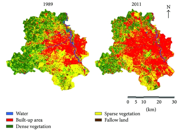
Land cover refers to the surface cover on the ground, whether vegetation, dense forest, water, bare soil or other. Identifying, delineating and mapping land cover is important for global monitoring studies, resource management, and planning activities.Land use refers to the purpose the land serves, for example, recreation, wildlife habitat, or agriculture. This knowledge will help develop strategies to balance conservation, conflicting uses, and developmental pressures. Issues driving land use studies include the removal or disturbance of productive land, urban encroachment, and depletion of forests.
Ecomen has conducted baseline studies of Land cover and Land use using thematic maps has helped in timely information required to know what current quantity of land is in what type of use and to identify the land use changes from year to year.